Search & Revival of River Saraswati (2 Viewers)

swesh

Trainee
Member
Joined
Jul 8, 2024
Messages
543
Likes
1,170
Country flag
Written by Divya A | New Delhi | Updated: March 9, 2016 7:28 am

Last week, the Haryana government changed the name of Mustafabad tehsil in Yamunanagar district to Saraswati Nagar. The renaming of Mustafabad, home to over 8,500 people, was done to brand it as the place that marks the discovery of the mythical river Saraswati. Haryana’s first BJP government, headed by Chief Minister Manohar Lal Khattar, has sanctioned Rs 500 million for the excavation of the river. Construction of a palaeo-channel, digging of borewells, carbon-dating and other works have already been initiated.

Centre’s role

On the same day that Haryana renamed Mustafabad, the central government set up a panel under former Kumaon University vice-chancellor Prof K S Valdiya to verify Haryana’s claims. Union Minister for Water Resources Uma Bharti said the “task force” comprising Valdiya and other water experts and historians would look into the apparent discovery of the lost river in Haryana and Rajasthan. Traces of underground water flow were found in Yamunanagar last year. “The Ministry will think further about the river only after the veracity of the claim is established,” Bharti said.

Other voices

In the ongoing session of Parliament, Col Sonaram Choudhary, BJP MP of Barmer, asked Finance Minister Arun Jaitley to make provisions in the Budget for researching and re-discovering the “lost” Saraswati. The Vasundhara Raje government has already prepared a detailed project report on the search. In 2014, the BJP MP from Ambala, Rattan Lal Kataria, moved a motion in Parliament seeking a “Saraswati Research Institute” for the “revival” of the river.

NDA’s pet project

The BJP and NDA have always been enthusiastic about “finding” the lost river. In 2002, the Atal Bihari Vajpayee government gave the job to a high-power panel headed by Culture Minister Jagmohan, with 36 months to complete the project. Two years later, the UPA came to power and scrapped the project. The Modi government intends to revive it, with the Ministry of Culture as the nodal agency and the ASI as the implementation agency.

Myth, mythology, literature

The Saraswati finds mention in the Rig Veda — likely composed between 1,500 BC and 1,200 BC — which speaks of the river flowing between the Yamuna in the east and the Sutlej in the west. The Mahabharata, which reached its final form probably in the 4th century AD, mentions that the Saraswati dried up in a desert. There are indications of a Saraswati river in a 17th century map by Van den Brouck and the poet Bipradas Pipilai’s Manasamangal kavya, but these refer to a stream in Bengal.

The Lost River: On The Trail of the Sarasvati, Michel Danino’s 2010 book, presents numerous arguments from topography, geological studies and satellite imagery to support the view that the dried up riverbed of the Ghaggar-Hakra was the vedic Saraswati river. The Ghaggar-Hakra once sustained the Bronze Age Harappan civilization, which flourished between 3500 BC and 1300 BC.

Modern theories

Those who believe in the existence of the Saraswati say the river is represented by the Ghaggar and its tributaries in Haryana, Punjab, Rajasthan and Gujarat, and the Cholistan region in Pakistan.

The dried-up palaeochannel of the Ghaggar is being explored, and its course is being excavated. ASI has excavated several sites from present-day Adibadri in Haryana’s Yamunanagar district to Khirsara in Rajasthan’s Kutch district. Last year, the mounds of Binjore in Rajasthan’s Ganganagar district were excavated.

Another theory suggests that the Helmand river of southern Afghanistan corresponds to the Vedic Saraswati; yet another set of people believes the Saraswati is a mythical river that forms a confluence with the Ganga and Yamuna at the Triveni Sangam in an invisible form.

Search so far

Despite efforts by geologists and scientists since the 19th century, nothing concrete has emerged to establish the existence of the Saraswati. Post-independence, as Harappan sites got scattered across India and Pakistan, the efforts to locate the river too became scattered. The identification of the Saraswati with the Ghaggar-Hakra was proposed by the first generation of orientalists and Indologists such as Christian Lassen, Max Müller and Aurel Stein in the 19th and 20th centuries. Between 2002 and 2004, the ASI conducted excavations under the Saraswati Project at 10 sites along the route. These include Adibadri, Kurukshetra, Fatehabad and Hisar in Haryana, Ganganagar and Hanumangarh in Rajasthan, and Kutch in Gujarat. The ASI also conducted independent excavations in 2009-13 at Khirsara (Gujarat) and in 2012-14 at Karanpura (Rajasthan), but says that only a multidisciplinary approach involving the Geological Survey of India and other agencies can establish a conclusive link between the Saraswati and Ghaggar-Hakra
 

State or Center didn't authenticate Saraswati project report: RTI
TNN | Jun 12, 2016, 01.03 AM IST

Chandigarh: On the contentious issue of existence of mythological Saraswati River, the Yamunanagar district officials have admitted that their project report for digging the river's track was not authenticated by the Haryana government or the Centre. The revelation was made before the state information commission recently after an RTI activist P P Kapoor approached the panel demanding details.

The only source for initiating digging work for revival of the river was a primary survey conducted by a district-level officer of panchayat department on the basis of revenue records. Kapoor, who has struggled a lot to access the information for one year, approached the commission to know whether the report of district-level officer or the project work was authenticated by state government, central government or any international agency.

Yamunanagar deputy commissioner S S Phulia and district development and panchayat officer (DDPO) Gagandeep Singh told the panel that "no report from the state government or any other higher level have been received by the administration in connection with the Saraswati project as related to Yamunanagar district."

The officials had also informed Kapoor that they don't have satellite images of ISRO, which had been mentioned earlier as a proof of palaeo-channels of the lost river. In reply to Kapoor's RTI query, A R Chaudhri of Kurukshetra University's geology department said that existence of the river was a matter of research and its completion would take its own course.

"Now, it has become clearer that the claims of locating disappeared Saraswati were made without any evidences," said Kapoor. The government has already approved Rs 50 crore for the Saraswati project.

Meanwhile, state information commissioner Samir Mathur, in a recent order, has stated that the administration has to explain the delay in providing information to the applicant. Earlier, the panel had issued two show cause notices to impose penalty of up to Rs 50,000 on a senior officer associated with the project. The panel has asked the officials to send the replies of notices by June 15.

Hunt to trace lost river
The BJP government in Haryana had started digging a 3km stretch near Mugalwali village in Yamunanagar district on April 21, 2015, as part of its great Saraswati hunt. The general theory given by supporters of the project is that the river used to flow above ground around 5,000 years ago but disappeared because of earthquakes. The Haryana government, however, still believes that it is possible to revive the channel. Kapoor said that senior ministers of Haryana government along with saints had also visited the sport in 2015, calling discovery of water at a few feet's depth a big achievement.
 

VIPIN PUBBY @vipinpubby

Come July 30 and a unique attempt will be made to artificially recharge the mythical Saraswati river which is believed to have originated from Adi Badri now in Haryana.

The attempts to revive the holy river, which has dried up and is believed to have gone underground, is being made under the aegis of the BJP government in Haryana.

The state government is set to pump water into the "lost river" through the Dadupur feeder from the Uncha Chandana village.

The government has already cleaned up and widened the nallah (channel) which passed through the districts of Yamunanagar, Kurukshetra and Kaithal districts of Haryana before entering Rajasthan and then on to Gujarat.


The work to clean and widen the nallah has already been completed in two phases of 37km and 55km to re-establish links with patches which had dried up over the centuries.

The total length of the river in Haryana is 153km and the work to widen the channel has been undertaken by the Saraswati Heritage Development Board (SHDB) formed by the Haryana Government.

With water from the monsoon rains already flowing in some parts of the nallah, the boost from the Dadupur channel is aimed at providing a continuous flow. The ultimate aim is to construct a dam at Adi Badri to regular water into the river.

Union minister of state for culture and tourism, Mahesh Sharma, took a meeting on Monday, July 25, to monitor the progress of the project.

It was decided to appoint a world class consultant for the project to boost heritage and cultural tourism. It was also decided to appoint a nodal agency for geological studies to trace the route of the mythical river. It was also decided to start an inter-state dialogue for coordination on the project.

Deputy chairman of SHDB, Prashant Bhardwaj, said the amount of water to be pumped in through the Dadupur feeder is yet to be decided. Since it would be a test run on July 30, the final decision would be taken later on the quantity of water required to revive the river.

The move to revive the mythical river, which finds mention in the Vedas as well as the Bhagavad Gita, was initially taken up during the tenure of the first NDA government under Atal Bihari Vajpayee in 2002.

The then Union tourism and culture minister, Jagmohan, had ordered studies on the underground river.

He had constituted a committee of four experts including a scientist from the Indian Space Research Organisation (ISRO), Ahmedabad, an eminent archeologist and a glaciologist.

The committee was asked to explore excavation from Adi Badri to Bhagwanpura in Haryana and in the second phase from Bhagwanpura to Kalibangar on the Rajasthan border.

The committee was also asked to explore the deepening of two wells, which according to mythology, were associated with the Pandavas.

Incidentally, the Rajasthan Groundwater Department too had undertaken a similar project in the mid-1990s to link a network of water channels in Rajashthan.

Jagmohan had also referred to satellite imagery of an underground channel. The imagery had shown patches of water bodies along the mythological route of Saraswati.

A remote sensing study conducted by the Geological Survey of India had also found existence of palaeo channels on the west of the Aravalli range and it was believed that these could be part of a river system ending in the Rann of Kutch.

The project was dropped after the Manmohan Singh government took over at the Centre and was revived only by the BJP government in Haryana led by Manohar Lal Khattar.

The chief minister had earmarked Rs 50 crore to trace and revive the river.

The state government, while deciding to set up the SHDB, declared, "The board will conduct meticulous field work to unearth and understand the past and the present content of the Saraswati heritage in Haryana for exposition of cultural patterns and values. It will help to preserve and promote the various archaeo-cultural facets of the Saraswati Heritage Area."

The Khattar government cried eureka when water was found after digging along the perceived route of the Saraswati last year.

Water was found at a depth of seven to eight feet in pits dug in a row over the supposed bed of the Saraswati.

This fact together with the discovery of ancient artefacts as well as evidence of ancient marine life was touted as re-confirming of the fact that a river flowed along the route and that an ancient civilisation existed along its banks.

Ever since the discovery of water, people from nearby areas have been flocking to the site and a few small temples have already sprung up along the route.

All eyes would now be on the experiment to discharge water on the route of the mythical Saraswati later this week
 
Communist historians and proponents of the aryan invasion theory deliberately prevented research and hunt of Saraswati river. Result is that today's generation thinks of this as some myth in a holy book.

Over the few decades if even if small efforts like rain water harvesting, check dams were undertaken the river could at least have been a seasonal one today.

I have lived in Panchkula, where there are canals which run with river force during monsoons. Why did we ever not harness that water?

Kudos to Khattar led Haryana govt for these initiatives. Constitution of a board to manage these efforts, using MANREGA man days etc is all sensible stuff.

An older, detailed report from Tribune last year:

http://www.tribuneindia.com/news/su...e/unearthing-the-saraswati-mystery/81447.html

Rigveda, the oldest of the four ancient Hindu texts, mentions the “mighty” Saraswati 45 times. When NDA’s former Culture minister Jagmohan ordered excavation in Haryana to trace the course of this mythical “lost river” in 2002, he faced criticism of pushing the Sangh Parivar’s agenda of equating the supposed pre-Vedic Harappan era with Hindus in the garb of promoting religious tourism. A related charge was of trying to establish the indigenousness of Hinduism while discounting the Aryan invasion theory, and making it appear as a continuing 5,000-year-old civilisation centered around the Saraswati.


Denying giving Saraswati a civilisational virtue or aiming to revive Brahmanism and the sanctity of Vedas, he said it was not important whether the river was found or not. “However,” he pointed out, “in the course of the research, a certain consciousness will find its way into the minds of the people... that it was not a mythological desert river.”


That consciousness seems to have seeped in. The Saraswati river as a reality has still not won the day, but it being a myth is losing ground as the earth is being dug up since April 21. At Rohlaheri village in Yamunanagar, fresh water has been found not far below at 7 feet, bringing a flood of outsiders and locals to the excavation site. Such is the rush that a community kitchen (bhandara) has been set up in the vicinity. Some are simply inquisitive, but there is a sprinkling of those who want to immerse themselves in the “holy goddess”. The Ramayana, Mahabharata, Brahmanas and Puranas all talk of Saraswati, some even calling it Brahma’s sacred daughter Ikshumati — the greatest of mothers, greatest of rivers and greatest of goddesses.


Locals say a number of seasonal rivulets in the area are dotted with small temples, alluding to the notion that the river has always existed — in their minds, at least. It was March this year that Haryana’s BJP government announced excavation of the Saraswati river from Adi Badri, the point from where it is said to have originated. The digging is to be spread over 43 villages of Yamunanagar district starting from Rohlaheri (Bilaspur tehsil) to Uncha Chandna (Mustafabad sub-tehsil), a distance of 50 km.


The government says the “revival of the ancient river” will take a couple of years, but to begin with, a 7-km water channel will be dug up. This, it claims, will act as a link for a dam and reservoir to be built subsequently over 1,000 acres. What will become of such plans is best left to the travails of time. Can an extinct river be revived by bringing underground water to the surface?


The work is being executed under the rural job guarantee scheme and around 400 families have been entrusted with the task. Chief Minister Manohar Lal Khattar has announced Rs 50 crore for the project, though the administration is yet to receive this money.


The Development and Panchayats Department says it has conducted the demarcation by using satellite imagery. Another claim is that advanced technology resulted in the discovery of water “from Saraswati” at Mughalwali village. Water gushing out is no myth, 2,500-3,000 people paying a visit daily and some taking the “holy water” too is a fact. But is this the fabled Saraswati, or just a seasonal channel?


Marwa Khurd village resident Sohan Lal, 70, can’t understand what the confusion is. “I have seen Saraswati flowing near Bilaspur (in the area of Kakroni village) for many years. The goddess has always existed,” he says, referring to one of the many seasonal rivulets. The myth is a reality in his case. No confusion. “Saraswati is our cultural heritage and we are working on the path shown by satellite images. Water being found from the site has proved its past. The excavation is going on and after completion of the work, there would be a flowing Saraswati,” says a confident Khattar.


Former Congress state secretary Satpal Kaushik exercises caution. “I am not questioning the existence of Saraswati in Yamunanagar. But, it is a fact that the water that came out in Mughalwali is not that of the Saraswati. It may be ground water,” he says, adding that the excavation will create a new problem for farmers as it will divide the land.


District Development and Panchayat Officer (DDPO) Gagandeep Singh has a bigger picture in mind. He says the Saraswati revival project has multi-dimensional aspects such as water conservation, water harvesting, ground water recharging, flood protection, improvement in ecological balance, flourishing of flora and fauna and development of eco-tourism, recreation tourism and pilgrim tourism. Is this long list for real?


Going back and forth

Hindu mythology refers to Saraswati as the goddess of wisdom and knowledge, manifesting itself in the form of a river. “Ganga, Jamuna, Saraswati” find a common mention in many theological and cultural contexts. The Rig Veda refers to Saraswati as the mighty river flowing from the high mountains to the sea. In fact, the Vedas lay more importance to Saraswati than Ganga.


French scholar Michel Danino in his book The Lost River: On the Trail of Sarasvati suggests that Saraswati was no mythological river. He says there is strong evidence to suggest that the Saraswati of yesterday could be the Ghaggar of today.


A major proponent of making the Indus civilisation and the Rigveda compatible has been BB Lal, former Director-General of the Archaeological Survey of India (ASI). He claims that the Rig Vedic Saraswati and the present-day Saraswati-Ghaggar combine, which flows through Haryana and Punjab and dries up near Sirsa, are the same. His theory thus refutes the Aryan invasion theory.


Indus and Saraswati, Danino writes in his book, were the lifeline of the Indus Valley and Harappan civilisation (between 3,500 and 1,900 BC). Ancient Sanskrit texts as well as maps plotted by the British some 200 years ago indicate that Saraswati was the Ghajjar-Hakra river (Ghaggar in India and Hakra in Pakistan) that passes through Haryana.


Archaeologist Marc Aurel Stein recorded in 1880s that the easternmost tributary of Ghaggar was still known as Sarsuti at that time, which he said was a corruption of the name over a period of time. Richard Dixon Oldham, an officer of the Geological Survey of India, suggested around the same time that geological changes and tectonic movement were responsible for the Saraswati changing course and finally drying up. He suggested that Sutlej and Yamuna were tributaries of Ghaggar-Hakra. Geological changes diverted Sutlej towards the Indus and Yamuna towards the Ganga. As a result, Saraswati did not have enough water to reach the Arabian Sea and it dried up in the Thar Desert that extends from Rajasthan into some portions of Haryana, Punjab and the Rann of Kutch in Gujarat.


What science offers, and the critique


Research conducted by various institutions, including the Indian Space and Research Organisation (ISRO), has suggested the course of the Saraswati. Satellite images have unearthed the hidden course of what could be the Saraswati river below the sands of Thar Desert in Rajasthan. As per an ISRO report, the mapped course of the river is 4-10 km wide, passing through Haryana, Punjab, Rajasthan and Gujarat, confirming the findings of Oldham.


Geological studies carried out to ascertain the existence of a palaeo-channel — remnant of an inactive river or stream channel that has been either filled or buried by younger sediment — in the north-western alluvial plains by the Department of Geology, Kurukshetra University, highlight the presence of a river system in the area demarcated for excavation.


Prof Dr AR Chaudhri, chairman, KU’s Department of Geology, says studies have indicated that Saraswati boosted the development of Vedic civilisation. “The sedimentological characteristics of the alluvium in Kalayat and palaeo-riverbed near Kurukshetra point to the presence of a trans-Himalayan river system. The channel, which is being excavated in Bilaspur area of Yamunanagar district, is along the palaeo-path of the erstwhile river which has been identified as per the official revenue record of British era,” he says.


Saraswati, it is believed, got lost due to tectonic movement. “Satellite images obtained from ISRO prove palaeo-channels of the lost river still exist below the ground,” says Darshan Lal Jain, president, Saraswati Nadi Shodh Sansthan, who’s been advocating the revival of the Saraswati since 1999.


Those claiming that Saraswati is no more a myth cite research in the fields of archaeology, geology, hydrology, glaciology, remote sensing and ground water technology. Even revenue records with entries that mention the Saraswati are given as evidence.


In revenue records, Saraswati travels from Adi Badri of Yamunanagar district to Pehowa in Kurukshetra district. Along this site are several historical temples. One such place believed to be the dry basin of Saraswati is where Lord Krishna is said to have delivered preachings of the Gita. It is believed that the battle of Mahabharata was also fought on the dry bed of Saraswati river.


There is a folklore associated with this site. Wherever the river flows, there are shamshan ghats (cremation grounds) on the embankment. The locals do not go to Haridwar for immersion of ashes in the Ganga. They treat Saraswati as an equally holy river and immerse the ashes in the open fields, believing that the river flows there. “When we were young, the water (believed to be of Saraswati) flowed in our village. After the cremation, the villagers would immerse the ashes in the water of the river,” claims Ram Narain of Rohlaheri village.


However, there are historians who say the Saraswati might not have been a mighty perennial river. They say remote-sensing and satellite imagery of palaeo (past) channels begin in the north, move towards Rajasthan and then get lost. There is hardly any proof, they claim, of these images being that of the Saraswati. They also point out how remote-sensing does not reveal the antiquity of the images, is not capable of dating and is ineffective on moist soil.


Looking back, ahead

GN Srivastva, Superintending Archaeologist, Chandigarh circle, has collected samples of pebbles and earthen pottery from Mughalwali. “The earthenware is of the Rajputana period from the eighth to the 12th century. The Saraswati river passage found in Yamunanagar and Kurukshetra has links to Prachi-Saraswati of Pehowa (Kurukshetra),” he says. “The Prachi-Saraswati river is mentioned in the stone inscription of the time of King Bhoj of Pratihar dynasty, ruling in the 9th century AD.”


A report of the Central Ground Water Board for Yamunanagar prepared in 2007 says the three blocks of Bilaspur, Mustafabad and Radaur have moved in the category of dark zone due to over-exploitation of underground water and mismanagement of ground water. The report recommends construction of a reservoir in the Kandi belt to enhance ground water and underground water quality and quantity.


Several agencies are involved in the Saraswati project and the Haryana government has hired the Water and Power Consultancy Services (India) Limited (WAPCOS) to prepare a detailed project report for revival of the river. Other agencies to be involved include the United Nations Development Programme, NABARD and Asian Development Bank.


Director (Exploration), Oil and Natural Gas Corporation, Dr NK Verma, has also helped in narrowing down the location for drilling of deep borewells for tapping of the Saraswati river palaeo-channels. The ONGC has committed to carry out drilling of deep borewells in the “Saraswati river course”.


Deputy Commissioner Dr SS Phulia says the “ONGC has identified three points in Yamunanagar district and one each in Kurukshetra, Kaithal and Fatehabad districts to install tubewells in the Saraswati river course”.


So, it is the fabled Saraswati? It is not a no. It’s not a convincing yes either.


COUNTING THE GAINS OF RIVER REVIVAL PROJECT


  • Yamunanagar Deputy Commissioner Dr SS Phulia claims the excavation will help in preventing flooding in the area. He says crores are spent on flood protection works on the Somb river every year.
  • The project, he says, will help in reclaiming thousands of acres of land that is rendered unusable during monsoons. The administration has associated the revival of Saraswati with construction of a dam, artificial reservoir and channelising untamed drains during monsoons, he adds.
  • The reservoir to harness rainwater is expected to be more than double the size of Sukhna Lake at Chandigarh.
  • A recreational water park, botanical garden and zoo will also be constructed. The Chief Minister has announced an express highway along the Saraswati Revival Project which will start from Kalka (Panchkula) and run up to Kalesar (Yamunanagar).
  • A temple of Goddess Saraswati is proposed on the embankment of the reservoir. A historical gurdwara (Rampur Kamboyan) already exists. But the work regarding the construction of the dam and the reservoir will start only after project reports. The project is expected to be executed in two years.
LOTS TO SAY ABOUT THE RIVER


  • Rigveda calls Saraswati the seventh river of the Sindhu-Saraswati river system, hence the name Saptsindhu for the region bound by rivers: Saraswati in east, Sindhu (Indus) in west.
  • Ancient texts say the Saraswati springs from Himalayan glaciers in Har-ki-dun in Uttarakhand and emerges at Adi Badri, 30 km north of Jagadhri (Haryana), through the foothills of Shivalik ranges. About 5,000 years ago, it traversed 1,600 km, through Himachal, Haryana, Punjab, Rajasthan and Gujarat.
  • Around 3,500 years ago, tectonic changes caused river migration and its desiccation.
  • Modern quest for the Saraswati began in the 1970s when American satellite images showed traces of water channels in northern and western India that had disappeared long ago.
  • The finding of Saraswati river disproves the Aryan invasion theory, which states that Aryans who originally lived in central Asia migrated to India in around 1,500 BC attacking the local Dravidians and moving them south.
  • Saraswati Heritage Project was started in 2002 by NDA. It was dropped by the UPA after a parliamentary panel termed it an unscientific quest.
  • CPM’s Sitaram Yechury, former panel head, said the project’s justification was mythological, not archaeological.
  • Some believe monsoon-fed Ghaggar-Hakra river, which flows through northwest India before entering Pakistan, is a remnant of the Saraswati.
 

Posted at: Aug 11, 2016, 12:35 AM; last updated: Aug 11, 2016, 12:35 AM (IST)

Trial run on Saraswati river
1749921523838.webp
Shiv Kumar Sharma

Tribune News Service

Yamunanagar, August 10


The trial run of releasing water into the Saraswati river has been successful in Yamunanagar district.


The trial was conducted in the 11-km area of Yamunanagar district from Uncha Chandna village to Jhivrehri village. The water has now entered the area of Kurukshetra district and is expected to reach Kurukshetra city soon.


Sources said the 25 cusecs water was released into the river from Uncha Chandna village at 3 pm on August 3. The water was later increased to 50 cusecs on August 6 and it would be further increased to 150 cusecs soon.


Prashant Bhardwaj, deputy chairman, Haryana Saraswati Heritage Development Board, said the trial run of had been going on since August 3.


The sources said in the first phase, the water of the river would be flown into the Ghaggar river in Kaithal district till the rest of the portion of the river was excavated in other districts.


They said the water was being supplied to the Saraswati river from the Dadupur head through the Shahbad-Nalvi feeder. The water of Som, Pathrala and Yamuna rivers (through Western Yamuna Canal) gets collected at the Dadupur head.


“The revival of the Saraswati will solve several purposes, including religious sentiments of the people, recharging of groundwater in an area facing the problem of low water table, interlinking of rivers, maximum use of rain and floodwater in dams and reservoirs,” said Bhardwaj.


The sources said the excavation work of the river had been started with the efforts of Darshan Lal Jain, president, Saraswati Nadi Shodh Sansthan, on April 21, 2015, and Chief Minister Manohar Lal Khattar is also taking keen interest in the work.
 

A villager shows the algae floating on Saraswati. Express Photo by Jaipal Singh

From Uncha Chandna, a village in Haryana’s Yamunanagar district, about three feet of water now flows through a channel that the Haryana government has deemed to be the route of the River Saraswasti.

Uncha Chandna is where earlier this month the Haryana Irrigation Department inaugurated its version of the Saraswati with a little bit of help — 100 cusecs to be exact — from the Dadupur-Nalvi feeder canal that brings water from the Yamuna to meet the irrigation demands of 225 villages in three districts of the state, Yamunanagar, Kurukshetra and Ambala.

Like it or not, this 100 cusecs of Yamuna water — one cusec equals 28.317 litres of water — from the feeder canal is now the water of the Saraswati. And at the time of writing, some 10 days after the inauguration, these cusecs had flowed up to Kurukshetra, 40 km to the south, surmounting the caving in of the sides of the channel at various places from the shock of the surging water.

After crossing Kaithal district, and crisscrossing Punjab for about 4 km, the water will merge with Ghaggar — a total distance of 153 km — with help from a booster shot of another 100 cusecs in the coming days.

Some 55 km north of Uncha Chandna is Adi Badri, commonly believed as the starting point of the “lost” Saraswati, in a wooded part of Yamuna Nagar close to the Shivalik foothills. The Irrigation department has already cleared a route on 37 km of this distance so that the River Somb, a small tributary of the Yamuna which runs its course in Yamunanagar, and its little rivulets here and there, can all be linked and flow without interruption towards Uncha Chandna, so that they can join the man-made Saraswati. The work on the remaining 18 km is proving tough. For along the route from Adi Badri to Uncha Chandna, lie many villages, whose fields are in the way of Mission Saraswati.

The government says there are land revenue records to prove that the fields have come up on what used to be a river.
Privately owned land will be acquired for the

The idea that there was a river called Saraswati comes from references to it in the Rig Veda. Academics, historians, archaeologists, geologists and other scientists, believers and non-believers remain bitterly divided about its


Liberal historians hold the view that the people of the Vedic age were migrants from what is now Central Asia. They view the Saraswati Mission as an attempt by Hindutva lobbies to draw a connection between the Vedic period and Harrapan culture to prove that the people of Vedic India were indigenous. Their Hindutva counterparts denounce them as pushing a “Marxist” view of history.

The BJP government in Haryana wasted little time in announcing its plan to find the Saraswati after coming to power. Haryana Chief Minister Manohar Lal Khattar had termed the project to unearth Saraswati as a “mission to keep alive the soul of a community”, :cool1: making no effort to hide the saffron colour of the project.

A Saraswati Heritage Development Board was quickly set up, and work began. But the foundation for the revival of the river was actually laid by the previousCongress government led by Bhupinder Singh Hooda that completed the construction of the first phase of the Dadupur-Nalvi canal in 2009.

The BJP government’s efforts got a boost when water was found in the dry river bed of the river at Mugalwali in Yamunanagar district in May last year. People flocked to the site to offer prayers and take the “holy” water. The government got the digging done under the Mahatma Gandhi Rural Employment Guarantee Scheme. The work was initiated on April 21.

District Development and Panchayat Officer, Yamunanagar, Gagandeep says, “After passing through 41 villages from Kaithal district, the river course enters Rajasthan and from there to Gujarat. There is satellite imagery of ISRO and Survey of India maps to show that the river existed here. We also have revenue records that show a river. These records were matched with the depressions. Some pieces of pottery were also recovered from the site that shows that a civilization existed here, which means there must have been a river.”

Project Saraswati is a package of other measures, including flood protection, promotion of eco and pilgrimage tourism, water conservation and improving the ecological balance. The government had announced a budget of Rs 50 crore for various works to be undertaken.

Three dams are also planned to ensure the river flows perennially. One of the dams will be at Adi Badri, another at Lohgarh and the third at Haripur. Officials say that river Somb floods the fields during the monsoon. A reservoir will be constructed at Uncha Chandna to channelise this water. While the reservoir is likely to be constructed in a few months, the dams will take two to three years to complete.


In March this year, the Centre set up an expert committee to review the available information about the river from studies already conducted. In a meeting of a multidisciplinary committee held recently at Delhi, discussions were held on the possibility of hiring consultants to promote tourism around the river.

The findings following excavation at Rakhigarhi has led officials to make claims that the river flowed here as Harappan settlements are known to have come up along riverbanks.


A board at the entrance with a picture of goddess Saraswati welcomes visitors to Saraswati Nagar, a village that is 1 km ahead of Uncha Chandna, in the direction of Adi Badri. Till February this year, it was known as Mustafabad. But going by its present condition, Saraswati might not want to be associated with this place, and pilgrims and other tourists would be shocked if they came.

There is no shortage of sign boards directing visitors to a Saraswati temple and a dham in the village, nor of garbage strewn around the site with pigs and stray dogs foraging in it.

Anil Chauhan, an agriculturist who frequently visits the temple, says it has expanded over the years. He feels there needs to be more upkeep in case the government wants to promote tourism.

“Adi Badri gets a lot of visitors and has tourism potential. However, if the government wants to attract tourists here then care has to be taken for maintaining this place. It needs to be spruced up,” he said.

Another person, who has a shop in the area for the past three decades, says that with the change in name, the situation seems to have worsened.

“There is an absolute lack of maintenance here. How can the government hope to attract tourists? Even when I am selling packed items in my shop, the filth outside turns people away. I have seen the mounds of garbage increasing by the day. The government talks of Swachh Bharat campaign. It seems this village has been given a miss,” he said on condition of anonymity.

At a little distance from the Saraswati temple is a cremation ground. The route of the Saraswati river passes the rear side of the cremation ground. The ashes of the cremated bodies are dumped into whatever water there is now from the Somb. The water has a layer of algae floating on it, and the sides are lined with garbage.

Baldev Kumar, a tubewell operator, says the manner in which the river is being polluted it looks like “Narakwati”. He said, “The sewerage from several villages enters river. If this continues, then the purpose with which the government has undertaken the project will be defeated.”

Prashant Bhardwaj, deputy chairman, Saraswati Heritage Development Board, says the problem is being experienced at several villages but says it strengthens the evidence for a pre-existing river. “Cremation grounds were constructed on the banks of rivers. This is another piece of evidence that the Saraswati was present here. We are giving the option to villagers that alternative sites will be allotted for the crematoriums so that the river is saved from pollution,” he said.

He added attempts are also being made to create awareness among people to not pollute the water of the river.

He said this was not a problem only of Saraswati but of the Ganga and Yamuna rivers as well. People also need to make a contribution, he said.


This is not the first attempt to find the Saraswati. In 1985, Dr V S Wakankar, an archaeologist and Padma Shri awardee, claimed to have traced the basin of the Saraswati from Adi Badri to Kutch. A group of 30 experts, including the incumbent Chief Minister Manohar Lal Khattar, travelled on the route from Haryana to Gujarat from November 19 to December 20. Khattar who was a pracharak then was part of the yatra for three days.

In 1997, a Saraswati Research Centre was established at Chennai. Two years later, Haryana got a Saraswati Shodh Sansthan, headed by Darshan Lal Jain, former RSS president of the state. Between 1999 and 2000, during the time of the first Vajpayee-led NDA government, even the Indian Space Research Organisation got into the act to trace the route through GIS mapping. In 2002, the Centre notified a project for conducting multi-disciplinary study of the river. NDA’s former Culture Minister Jagmohan ordered excavation in Haryana to trace the river, a move that was viewed by the Opposition as furthering the saffron agenda.

Jain, ever the active campaigner for the Saraswati, says satellite imagery has shown the presence of the river. “It is no longer a myth,” he said. “Over the years, people have encroached upon land from where the river flowed. This needs to be cleared. It would facilitate in flood control and facilitate utilization of water.”

But now both Congress and Indian National Lok Dal have termed it a BJP ploy to divert attention from its failures and broken promises.

Undeterred by the opposition, the Khattar government is now planning to set up fellowships for the study of Saraswati river. At present, as many as 64 different departments across the country are involved with the Saraswati river project.

Politics and religion aside, Harinder, a landowner in Uncha Chandna village, feels the revival of the river will bring some benefits for the farmers.

“It is during the monsoons that we are assured of a steady supply of water in this river, otherwise we are dependent on tubewells. This is impacting the water level. The revival of the river will give us more water for irrigation. While the river has a religious significance, it is vital for farming. We had heard that the CM will come when water will released. That did not happen,” he says.

While debate rages among academics and historians over whether the river ever existed, for the residents of the Uncha Chandna and other villages on its path, the Saraswati river has always been present.

Seasonal rivulets flow through many villages in this part of Haryana. They fill up during the monsoon and dry down in the other months. People in these villages know them as the Saraswati, and have always done so in their memory. They see these rivulets as having originally come from a bigger river that dried up with time.

Chaman Lal, the sarpanch of Mali Majra, another village ahead of Uncha Chandna, says since the time he was born, he has known there was once a bigger river that flowed past his village called the Saraswati. “Our elders told us about it. The government is trying to revive the river along its entire route. Over the years, farmers started cultivating crops right next to the route of the river. As the river bed dries up during summers, some parts got encroached as well. This obstructed the smooth flow of the river. Also, the landowners do not want the government to use machines to clear the path of the river as their fields will get damaged,” he said.

Chaman Lal adds that over time, sewerage water and garbage are entering the rivulets. He fears this will finally end up in the new Saraswati, when the rivulets all get linked up. “The government needs to ensure that untreated sewerage does not enter the river. There will be no point spending crores of rupees on the project if the pollution is not stopped,” he said
 
Looking at the area from Google Maps:

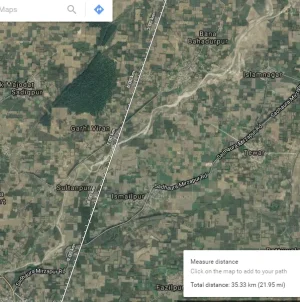
1. Adi Badri -> Uncha Chandna.

33.5 Km as crow flies and 55 Km, presumably by road. Adi Badri is the origin, wile Uncha Chandna is where water from Dadupur-Nalvi feeder canal is being pushed into the channel. I am considering this as the first segment where water has to flow naturally.
1749921996595.webp
Looking at the area, there are several rivulets/nallahs/seasonal rivers already in the area. Am letting the distance line above remain to give you a frame of reference.

1.1 Area near, South East to Adi Badri:
1749922046430.webp
1.2 Going south west .
1749922089773.webp
Beyond this visible river channels are not there ... from here on is where they have to acquire land to build the canal.
 
Did some more digging up in Google Earth.

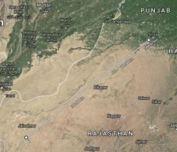
The Ghaggar river, which is a prominent seasonal river in Haryana and Punjab, goes quite a long distance into the Thar desert!

1749922175095.webp

The Saraswati being revived by Haryana Govt will merge its water into this very river.

Thus, the tough work is more at the source, as downstream has a wide channel that stretches all the way to Pakistan. With careful water harvesting, damming and developing water bodies - the revival may not be that far from reality. Sure, the revived river may not even flow the whole year, but the possibilities are tantalizing
 
To summarise, the present Haryana Govts efforts are in 2 segments:

A. Adi Badri to Uncha Chandna
B. Uncha Chandta to kaithal

From kaithal onwards it is ghaggar river:

C. Kaithal to sirsa (lake ottu)
D. Sirsa to thar desert
1749922266725.webp
 
1749922383953.webp
 
1749922595404.webp
About `Lost River Saraswati' - The `Lost Saraswati River' in NW India is the holiest and mightiest river of the Vedic Period (8000-5000 BP). The discovery of the sites of Harappan civilization along the banks of the Saraswati River indicates towards its mighty and magnanimity. Vedic Saraswati River originated in the Himalayas and flowed between Indus River in the west and Ganges River in the east through Punjab, Haryana, western Rajasthan and Gujarat. It is finally drained into Gulf of Kachchh in Arabian Sea. The Vedic Saraswati River disappeared around 5000 BP due to climatic and tectonic changes. It is believed that River Saraswati is still flowing below the Thar desert and its Himalayan connectivity is alive. The relict of this lost river is preserved as palaeochannels under the cover of aeolian sand / alluvium.

Saraswati River in Ancient Literatures - The name `Saraswati' has been used in most of the ancient literatures like Vedas, Manusmriti, Mahabharata and Puranas:
1. Vedas - There are frequent references of River Saraswati in Vedic literature (80 times more than that of River Ganges). No other river has received so much importance and respect as Saraswati. The Vedic hymns are composed by different Rishis (scholars) in the glory of River Saraswati. (a) Rigveda - Vedic Saraswati is described as `Best of Mothers, Best of Rivers, Best of Goddesses`. (b) Yajurveda - Saraswati has five important tributaries viz. Drishadvati, Satudri (Sutlej), Chandrabagha (Chenab), Vipasa (Vyas) and Iravati (Ravi). All these rivers merge to Saraswati to meet Sindhu Sagar (the Arabian Sea). (c) Atharvaveda - God bestowed the people on the bank of the Saraswati, with sweet juicy barley, where generous Maruts became farmers & Indra as the Lord of agriculture. This Mantra suggests that farming of cereals was practiced on the fertile soil of Saraswati during Vedic times.
2. Manusmriti - The land between the Saraswati and Drishadvati is created by God; this land is defined as Brahmavarta.
3. Mahabharata - Mahabharata gives clear geographical accounts of a number of pilgrimage sites spread along the course of the Saraswati River. Lord Balaram after visiting a number of holy places reaches to Vinasana, the place where the Saraswati disappeared. During Mahabharata period, the discharge of water in Saraswati became extremely low. As a result, the river vanished in the desert sand at certain place along its regular course i.e. at Vinasana. Hence, the river channel appeared dry.
4. Purana - Rishi Markandeya, close to the place where he meditated and offered sacrifices saw Saraswati rising from the Plaksha tree (Pipal tree). The sage prayed and worshiped the rising river.

Discovering `Lost River Saraswati' through Remote Sensing Techniques - Discovering the exact course of Vedic Saraswati River and its perennial source is a challenging task among the researchers due to lack of proper scientific database. The mystery is unravelled through modern tools like Remote Sensing and GIS by using multi-spectral and multi-resolution satellite images of optical and microwave data. ISRO centres could able to delineate most of the palaeochannels of Vedic Saraswati River and its linkage with the present day Himalayan Rivers.

Linkages of Vedic Saraswati with Himalayan Rivers -
(a) Linkage of Saraswati Nadi with Somb River at Adi Badri
(b) Linkage of Saraswati Nadi with Yamuna River
(c) Linkage of Saraswati Nadi with Vedic Saraswati
(d) Linkage of Sutlej Palaeochannel with Vedic Saraswati
(e) Linkage of Vedic Saraswati from Mannsarovar to Dwaraka

Utility of Palaeochannel Maps -

1. Cultural Heritage:
(a) Restoration of Historical sites and (b) Excavation of New Archaeological Sites.

2. Ground Water:
(a) Groundwater exploration and (b) Groundwater recharge

3. Tourism Sector:
(a) Renovation of temples and (b) Reconstruction of Ritual Sites along the bank of Saraswati River.


chrome-extension://efaidnbmnnnibpcajpcglclefindmkaj/https://bhuvan-app1.nrsc.gov.in/saraswati/usertasks/saraswati/docs/Report_Saraswati_Integrated_Nov.2014.pdf

chrome-extension://efaidnbmnnnibpcajpcglclefindmkaj/https://bhuvan-app1.nrsc.gov.in/saraswati/usertasks/saraswati/docs/Paper_Saras_Gupta%20et%20al._JISRS_2004.pdf

chrome-extension://efaidnbmnnnibpcajpcglclefindmkaj/https://bhuvan-app1.nrsc.gov.in/saraswati/usertasks/saraswati/docs/Saras_Gupta%20et%20al%20IJRS_2011.pdf

chrome-extension://efaidnbmnnnibpcajpcglclefindmkaj/https://bhuvan-app1.nrsc.gov.in/saraswati/usertasks/saraswati/docs/Paper_Saras_Sharma-Bhadra_I-Serve_2012.pdf
 
chrome-extension://efaidnbmnnnibpcajpcglclefindmkaj/https://bhuvan-app1.nrsc.gov.in/saraswati/usertasks/saraswati/docs/Paper_Saras_Bhadra-Sharma_Draupadi_2011.pdf
 
well we hv also a Saraswati river in uttarakhand....its in mana village near badrinath temple. its a tributery river of alaknanda river. its not vedas Saraswati river, but it hv stories of Pandavas crossing river during their swarg arohan. they passes from this river origin place. sharing this, so people know we hv another Saraswati river also. nd its big river (compare to other himalayan rivers in himayas area).
images (22).webp
images (23).webp
 
@swesh @Azaad

I have some points regarding the river Saraswati and would like to retrace its flow path. I'll start with my theories and would like you to chip in.

2.41.16: Greatest River/Godess/Mother of all
6.61.2: Mighty river flowing down the cliffs of steep mountains. Floods regularly, breaches both banks
6.61.8: mighty river, loud-sounding river
6.61.13: vastness, fastness
7.95.1: firm as a city made of metal, flows rapidly, sweeping away in its might all other waters
7.95.2: From mountains to ocean
7.96.1: most mighty of rivers

In RV, Saraswati is the most important river. Not only it is mentioned more number of times than Sindhu, it is directly compared and placed above Sindhu in hierarchy. Whatever little knowledge I have confirms the following,
  1. Saraswati was a real river
    1. Paleochannel confirmation
    2. Galicial sediments
    3. Excavations sites
    4. Mention in RV of a mighty river other than Sindhu, and reffered to as the most sacred, most reverred and most important one.
    5. Significance lost along the later vedic texts
    6. Mention of Saraswati in dying state in MB
  2. Current understanding (afaik)
    1. It is claimed that Sutlej and Yamuna made Saraswati. There may be smaller stream/s which might have been the main Saraswati stream, but the bulk of the volume was added by Sutlej and Yamuna merging in to this stream in the plains.
    2. It is said that due to some geological activity Yamuna's and Sutlej's feed was cut-off to Saraswati.
    3. Even after being cut-off from this feed the river was alive, albeit seasonaly, before drying up completely.
  3. My thoughts,
    1. Sutlej came down from the Kailash
    2. Saraswati came down from Banderpooch
    3. Yamuna was a branch of the Saraswati, or it was a smaller stream originating down Banderpooch and then merging with Saraswati again.
    4. Sutlej merged with Saraswati in the plains
  4. My reasoning
    1. If this theory works we can explain many things which I do not feel acceptable according to the current assumption of Saraswati being born at the Shivalik foothills by the merger of small streams, Yamuna and Sutlej.
    2. Saraswati is said to be a mighty river, roaring down the steep mountains. I have heard Beas in the mountains. No way can Saraswati be a smaller river if Beas' sound is not a 'roar' but Saraswati's is. Saraswati has to be a big river, high up in the mountains, to qualify to be described as it was.
    3. Geological activities up in the mountains are bound to have far more effects on river flow than on foothills or plains. I don't think diversion of Yamuna or Sutlej would have this drastic impact on Saraswati due to geological acitivities, if Saraswati was indeed a big river in the mountains.
    4. However, if Saraswati was indeed a big river in the mountains the chances of any such geological (esp. tectonic) activity changing river course is very high. Any such event along the Yamunotri glaciers could have cut-off Saraswati of its glacial feed and/or diverted the feed to Yamuna or created a whole new river channel which later became Yamuna (overlapping with the previous course, considering my idea of Yamuna being a divergent branch/smaller neighbouring stream).
    5. Another reasoning behind this thought is that I think the banks of Saraswati was where RV was wrote. People moved outwards with time and started settling along the other rivers. So when Saraswati started drying up, people started moving en masse.
    6. The movement was both eastwards (Ganga-Yamuna) and westwards (Sindhu), more towards west. Sindhu was the second most prominent river after the Saraswati and had much fertile lands due to the large number of rivers that irrigated that area along with geological proximity. Moreover Saraswati and Yamuna were dynamic due to the change of flow and must have been dangerous to tread through.
    7. The settlements near Saraswati, though bigger and larger in numbers, appears to be less sophisticated compared to the one found near Sindhu. Which cements my thought of a movement of the elite/scholars/craftsmen towards Sindhu. So we find similar tech in both Saraswati bank settlements and Sindhu bank settlements, but Sindhu ones shows further developement but Saraswati's stagnated.
I don't have any problems with the river flow along the plains, the paleochannel is quite clear. What I don't get is the origin of Saraswati.

Also, my understanding of IVC-Saraswati is simple. SSC formed on the banks of Saraswati. By the time RV was written it had reached quite a stable stage and had people expeditioning in search of newer lands along the banks of other rivers and were actively migrating and settling there. SSC may have experienced some time of the mature phase along the Saraswati but most of it was along Sindhu as the former had started drying right after the composition of the RV.

Request other memberans to add/subtract/modify to help me more and revive this thread for the time being.

*note: I haven't read the og RV. My ideas are shaped up by translations, inferences and AI. I don't possess evidneces but my thoughts are built more on logical reasoning.
 
Last edited:
@swesh @Azaad

I have some points regarding the river Saraswati and would like to retrace its flow path. I'll start with my theories and would like you to chip in.

2.41.16: Greatest River/Godess/Mother of all
6.61.2: Mighty river flowing down the cliffs of steep mountains. Floods regularly, breaches both banks
6.61.8: mighty river, loud-sounding river
6.61.13: vastness, fastness
7.95.1: firm as a city made of metal, flows rapidly, sweeping away in its might all other waters
7.95.2: From mountains to ocean
7.96.1: most mighty of rivers

In RV, Saraswati is the most important river. Not only it is mentioned more number of times than Sindhu, it is directly compared and placed above Sindhu in hierarchy. Whatever little knowledge I have confirms the following,
  1. Saraswati was a real river
    1. Paleochannel confirmation
    2. Galicial sediments
    3. Excavations sites
    4. Mention in RV of a mighty river other than Sindhu, and reffered to as the most sacred, most reverred and most important one.
    5. Significance lost along the later vedic texts
    6. Mention of Saraswati in dying state in MB
  2. Current understanding (afaik)
    1. It is claimed that Sutlej and Yamuna made Saraswati. There may be smaller stream/s which might have been the main Saraswati stream, but the bulk of the volume was added by Sutlej and Yamuna merging in to this stream in the plains.
    2. It is said that due to some geological activity Yamuna's and Sutlej's feed was cut-off to Saraswati.
    3. Even after being cut-off from this feed the river was alive, albeit seasonaly, before drying up completely.
  3. My thoughts,
    1. Sutlej came down from the Kailash
    2. Saraswati came down from Banderpooch
    3. Yamuna was a branch of the Saraswati, or it was a smaller stream originating down Banderpooch and then merging with Saraswati again.
    4. Sutlej merged with Saraswati in the plains
  4. My reasoning
    1. If this theory works we can explain many things which I do not feel acceptable according to the current assumption of Saraswati being born at the Shivalik foothills by the merger of small streams, Yamuna and Sutlej.
    2. Saraswati is said to be a mighty river, roaring down the steep mountains. I have heard Beas in the mountains. No way can Saraswati be a smaller river if Beas' sound is not a 'roar' but Saraswati's is. Saraswati has to be a big river, high up in the mountains, to qualify to be described as it was.
    3. Geological activities up in the mountains are bound to have far more effects on river flow than on foothills or plains. I don't think diversion of Yamuna or Sutlej would have this drastic impact on Saraswati due to geological acitivities, if Saraswati was indeed a big river in the mountains.
    4. However, if Saraswati was indeed a big river in the mountains the chances of any such geological (esp. tectonic) activity changing river course is very high. Any such event along the Yamunotri glaciers could have cut-off Saraswati of its glacial feed and/or diverted the feed to Yamuna or created a whole new river channel which later became Yamuna (overlapping with the previous course, considering my idea of Yamuna being a divergent branch/smaller neighbouring stream).
    5. Another reasoning behind this thought is that I think the banks of Saraswati was where RV was wrote. People moved outwards with time and started settling along the other rivers. So when Saraswati started drying up, people started moving en masse.
    6. The movement was both eastwards (Ganga-Yamuna) and westwards (Sindhu), more towards west. Sindhu was the second most prominent river after the Saraswati and had much fertile lands due to the large number of rivers that irrigated that area along with geological proximity. Moreover Saraswati and Yamuna were dynamic due to the change of flow and must have been dangerous to tread through.
    7. The settlements near Saraswati, though bigger and larger in numbers, appears to be less sophisticated compared to the one found near Sindhu. Which cements my thought of a movement of the elite/scholars/craftsmen towards Sindhu. So we find similar tech in both Saraswati bank settlements and Sindhu bank settlements, but Sindhu ones shows further developement but Saraswati's stagnated.
I don't have any problems with the river flow along the plains, the paleochannel is quite clear. What I don't get is the origin of Saraswati.

Also, my understanding of IVC-Saraswati is simple. SSC formed on the banks of Saraswati. By the time RV was written it had reached quite a stable stage and had people expeditioning in search of newer lands along the banks of other rivers and were actively migrating and settling there. SSC may have experienced some time of the mature phase along the Saraswati but most of it was along Sindhu as the former had started drying right after the composition of the RV.

Request other memberans to add/subtract/modify to help me more and revive this thread for the time being.

*note: I haven't read the og RV. My ideas are shaped up by translations, inferences and AI. I don't possess evidneces but my thoughts are built more on logical reasoning.

>tfw some stupid earthquake in the mountains deleted a yuge and muscular river

I used to think Saraswati was some smoll river fed by rain, what you have discovered make it seem large and chad like the Ganga.

Perhaps if Sarawati was still flowing we wouldn't have Thar desert or would that area be a desert onlee regardless?
The kind of respect Saraswati gets vis-a-vis Sindhu, Ganga, Yamuna makes me think of 2 reasons:
  1. It was a mighty river, wider than the Ganga, Yamuna, and Sindhu. That's why the praises.
  2. Or nationalistic chest-thumping. Saraswati Basin is my homeland, so RV writers put her on a pedestal.
But the paleochannel imagery makes me believe it was indeed a mighty river. It may have been branched, but it would surely be engulfing a wide area during peak monsoon.
1750249224270.webp 1750249280124.webp

The existence of Thar is independent of Saraswati. E.g., the Indus is a big river, but as you move slightly away from its banks, you find semi-arid and arid regions on both sides. Also food habits of people in places like Kalibagan and Dholavira show that arid/semi-arid regions existed even then.
1750249369002.webp
 
 
A. V. Sankaran
NEARLY ten thousand years ago when mighty rivers started flowing down the Himalayan slopes, western Rajasthan was green and fertile. Great civilizations prospered in the cool amiable climate on riverbanks of northwestern India. The abundant waters of the rivers and copious rains provided ample sustenance for their farming and other activities. Some six thousand years later, Saraswati, one of the rivers of great splendour in this region, for reasons long enigmatic, dwindled and dried up. Several other rivers shifted their courses, some of their tributaries were ‘pirated’ by neigbouring rivers or severed from their main courses. The greenery of Rajasthan was lost, replaced by an arid desert where hot winds piled up dunes of sand. The flourishing civilizations vanished one by one. By geological standards, these are small-scale events; for earth, in its long 4.5 billion years history, had witnessed many such changes, some of them even accompanied by wiping out of several living species. But those that occurred in northwest India took place within the span of early human history affecting the livelihood of flourishing civilizations and driving them out to other regions.

The nemesis that overtook northwestern India’s plenty and prosperity along with the disappearance of the river Saraswati, has been a subject engaging several minds over the last hundred and fifty years. However, convincing explanations about what caused all the changes were available only in the later half of the current century through data gathered by archaeologists, geologists, geophysicists, and climatologists using a variety of techniques. They have discussed and debated their views in symposia held from time to time, many of which have also appeared in several publications. Over the last thirty years, considerable volume of literature have grown on the subject and in this article some of the salient opinions expressed by various workers are presented.

Rivers constitute the lifeline for any country and some of the world’s great civilizations (Indus Valley, Mesopotamian, and Egyptian) have all prospered on banks of river systems. Hindus consider rivers as sacred and have personified them as deities and sung their praises in their religious literature, the Vedas (Rig, Yajur and Atharva), Manusmriti, Puranas and Mahabharata. These cite names of several rivers that existed during the Vedic period and which had their origin in the Himalayas. One such river Saraswati, has been glorified in these texts and referred by various names like Markanda, Hakra, Suprabha, Kanchanakshi, Visala, Manorama etc.1,2, and Mahabharata has exalted Saraswati River as covering the universe and having seven separate names2. Rig veda describes it as one of seven major rivers of Vedic times, the others being, Shatadru (Sutlej), Vipasa (Beas), Askini (Chenab), Parsoni or Airavati (Ravi), Vitasta (Jhelum) and Sindhu (Indus)1,3,4<strong> </strong>(Figure 1). For full 2000 y (between 6000 and 4000 BC), Saraswati had flowed as a great river before it was obliterated in a short span of geological time through a combination of destructive natural events.

1749031501797.gif


Judged in the broader perspective of geological evolution, disappearance or disintegration of rivers, shifting of their courses, capture of one river by another (river piracy), steady decline of waters culminating in drying up of their beds, are all normal responses to tectonism (uplift, faulting, subsidence, tilting), earthquakes, adverse climate and other natural events. Such catastrophic events overtook Saraswati river in quick succession, within a short geological span in the Quaternary period of the Cenozoic era (Figure 1) leading to its decline and disappearance. Similar changes to drainage of rivers have occurred during earlier geological periods also, much before human evolution. A few of the south Indian rivers like the east-flowing Pennar, Palar and Cauvery draining into the Bay of Bengal and west-flowing Swarna, Netravathi and Gurupur draining into the Arabian Sea are known to have changed their courses or got dismembered due to uplift of land. Today, their former courses or palaeochannels can be seen as dry beds5–8.

Saraswati – evolution and drainage

The river Saraswati, during its heydays, is described to be much bigger than Sindhu or the Indus River. During the Vedic period, this river had coursed through the region between modern Yamuna and Sutlej. Though Saraswati is lost, many of its contemporary rivers like Markanda, Chautang and Ghaggar have outlived it and survived till today. All the big rivers of this period –
Saraswati, Shatadru (Sutlej), Yamuna derived their waters from glaciers which had extensively covered the Himalayas during the Pleistocene times. The thawing of these glaciers during Holocene, the warm period that followed, generated many rivers, big and small, coursing down the Himalayan slopes. The melting of glaciers has also been referred in Rigvedic literature, in mythological terms, as an outcome of war between God Indra and the demon Vritra1,9. The enormity of waters available for agriculture and other occupations during those times had prompted the religiously bent ancient inhabitants to describe reverentially seven mighty rivers or ‘Sapta Sindhu’, as divine rivers arising from slowly moving serpent (Ahi), an apparent reference to the movement of glaciers3.

According to geological and glaciological studies11,13, Saraswati was supposed to have originated in Bandapunch masiff (Sarawati-Rupin glacier confluence at Naitwar in western Garhwal). Descending through Adibadri, Bhavanipur and Balchapur in the foothills to the plains, the river took roughly a southwesterly course, passing through the plains of Punjab, Haryana,
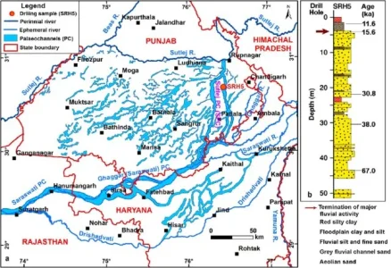
Rajasthan, Gujarat and finally it is believed to have debouched into the ancient Arabian Sea at the Great Rann of Kutch. In this long journey, Saraswati was believed to have had three tributaries, Shatadru (Sutlej) arising from Mount Kailas, Drishadvati from Siwalik Hills and the old Yamuna. Together, they flowed along a channel, presently identified as that of the Ghaggar river, also called Hakra River in Rajasthan and Nara in Sindh1,11 (Figure 2). The rivers, Saraswati and Ghaggar, are therefore supposed to be one and the same, though a few workers use the name Ghaggar to describe Saraswati’s upper course and Hakra to its lower course, while some others refer Saraswati of weak and declining stage, by the name Ghaggar12.

1749031612921.webp


philological debate has taken place about the roots of the nomenclature ‘Saraswati’, which is referred to by the name Harkhaiti or Haravaiti (in Avesta) in regions further west of India. The contentious point debated is whether the syllable Ha in the river’s name changed to Sa, later in India or Sa to Ha outside India. The choice of the name, Saraswati or Harkhaiti, depended upon whether one considered Aryans, the ancient inhabitants along this riverine system, as indigenous people who, upon their migration, carried the name Saraswati westwards where linguistic growth changed Sa soon to Ha; or, whether they were migrants from west of India who brought with them the name Harakhaiti which changed to Saraswati once they settled here2. Apart from the nomenclature, the riverine systems of the period draining northwestern India had generated considerable discussion among the scholars about the positions (hierarchy) of the other feeder rivers, big and small, their sources and causes for their shifts which affected the supply of waters to the main rivers hastening their disintegration, e.g. Saraswati and its major tributary, Drishadvati.

Hindu mythology records several legends and anecdotes that are intertwined with the river’s geologically brief existence. Every aspect of the river’s life, right from its birth to its journey down the Himalayas and over the plains towards the Sindhu Sagara (ancient Arabian Sea), have found mention in one religious text or other, like Rigveda, Yajurveda, Atharvaveda,
Brahmana literature, Manusmriti, Mahabharata
and the Puranas1–3. These descriptive legends have often proved helpful in cataloguing some of the natural events of the period and linking some of them with the river’s perturbations. For example, the graphic description of a war between Gods and demons detailed in one of these texts and use of fire (Agni) in the destruction of a demon hiding in the mountains which trembled under the onslaught may possibly refer to volcanic and seismic episodes of the period2. Today, more than 8000 years since the Vedas came into existence, some of the rivers mentioned therein have become defunct or have shifted from their original path. In the earlier years of study, their erstwhile courses were mainly inferred from archaeological evidences. These included sites of ancient settlements (some 1200 are known) of Harappan, Indus or Saraswati civilizations along river banks, the scripts and seals left behind, and references in Hindu mythology to river-bank Ashrams and Yagnya Kundams preserving evidences about the ritual worship practiced by the ancient inhabitants3,10–13.

Over a 3000 year-long period since the Vedic times (Figure 1), the drainage pattern of many rivers had changed much from that described in the earlier religious literature. The decline of Saraswati appears to have commenced between 5000–3000 BC, probably precipitated by a major tectonic event in the Siwalik Hills of Sirmur region. Geologic studies14 indicate destabilizing tectonic events had occurred around the beginning of Pleistocene, about 1.7 my ago in the entire Siwalik domain, extending from Potwar in Pakistan to Assam in India, resulting in massive landslides and avalanches. These disturbances, which continued intermittently, were all linked to uplift of the Himalayas. Presumably, one of these events must have severed the glacier connection and cut off the supply of glacier melt-waters to this river. As a result, Saraswati became non-perennial and dependent on monsoon rains. All its majesty and splendour of the Vedic period dwindled and with the loss of its tributaries, major and minor, Saraswati’s march to oblivion commenced around 3000 BC. Bereft of waters through separation of its tributaries15, which shifted or got captured by other neighbouring river systems, Saraswati remained here and there as disconnected pools and lakes and ultimately became reduced to a dry channel bed. Lunkaransar, Didwana and Sambhar, the Ranns of Jaisalmer, Pachpadra etc., are a few of these notable lakes, some of them highly saline today, the only proof to their freshwater descent being occurrences of gastropod shells in these lake beds16–19. With the decline and disappearance of Saraswati, the ancient civilizations, that it supported, also faded.

Inferences from geologic, remote sensing and geophysical surveys

Considerable tectonic activity connected with Himalayan orogeny continued during the Holocene and later times although uplifts to heights of 3000–4000 m were at their peak during 0.8–0.9 my span. The high elevation of the mountains perturbed the wind circulation patterns and induced climatic changes. Moderate terrain of earlier times became rugged and hilly affecting the channels of rivers14. That was the scenario of the Himalayan region when Saraswati emerged as a major river about 9000 y ago20 and flowed in all splendour during the vedic times till its decline to an impermanent monsoon dependent state some 4000 y later.

Bulk of earlier studies on Saraswati pertain more to the civilizations that flourished along its banks and many of the reasons attributed for the decline of this river were speculative. The impacts of middle to late Quaternary geologic events on the river systems in this region, however, had received only cursory attention. Awareness to the potentialities of geologic, meteorologic, climatic and other cyclic events, basically triggered by plate tectonism, earth’s orbital and tilt variations and similar global phenomena came up much later. Attempts to investigate their roles over the decline and desiccation of Saraswati began only since close of nineteenth century21–23 and gained momentum during the last three decades. Oldham23, a geologist of Geological Survey of India, was one of the first to offer as early as 1886, geological comments about Saraswati. According to him, the present dry-bed of Ghaggar River represents Saraswati’s former course and that its disappearance was precipitated when its waters were captured by Sutlej and Yamuna. This view differed from that of several others who felt that Saraswati vanished due to lack of rainfall. However, later-day meteorological research about palaeoclimates11,24–27, oxygen isotopic studies36, thermouminescenct (TL) dating28 of wind-borne and river-borne sands in the Thar desert region, radiocarbon dating of lake-bed deposits48 and archaeological evidences29,30 have all indicated that during early to middle Pleistocene period this region had enjoyed wetter climate, heavy rainfall and even recurring floods and that increase in aridity commenced by mid-Holocene (5000–3000 BC) only.

Intense investigations during the last thirty years have yielded fruitful data obtained through ground and satellite based techniques as well as from palaeoseismic, and palaeoclimatic records all of which had enabled a good reconstruction of the drainage evolution in northwestern India. In addition, TL-dating of dry-bed sands and isotopic studies of the groundwater below these channels provided useful links in these reconstruction efforts. The observed river-shifts and other changes could also be correlated with specific geologic, seismic or climatic event that occurred during the mid- to late-Quaternary period. Particularly helpful were the information gathered from LANDSAT imagery about location of former river courses in the plains and beneath the Thar desert upto the Rann of Kutch, about existence of palaeo-river valleys and identifying major structural trends (lineaments) in the region3,16,18,31–34. In spite of a large volume of such data, the chain of natural events during the Quaternary period has given rise to different interpretations about the former river courses.

Mainly, Indus and Saraswati, were the two major river systems of northwestern India during the Vedic period but the network of their tributaries, some of which are known to have deviated from their initial course or become non-existent today, have given scope for grouping these rivers into convenient classifications. Sridhar et al.18 have classified the rivers into four main groups (Figure 2) – (i) Sindhu (Indus) and its tributaries Vitasta (Jhelum) and Askini (Chenab); (ii) Shatadru (Sutlej) and its two major tributaries Vipasa (Beas) and Parasuni or Iravati (Ravi); (iii) Saraswati and its three tributaries Markanda, Ghaggar and Patialewali, in its upper reaches and a major tributary in its middle course; (iv) Drishadvati and Lavanavati. Baldev Sahai19 grouped them into Sutlej, Ghaggar and Yamuna systems while Yash Pal and co-workers32 recognized only two major systems –
the Sutlej and the Ghaggar.
1749031817636.gif

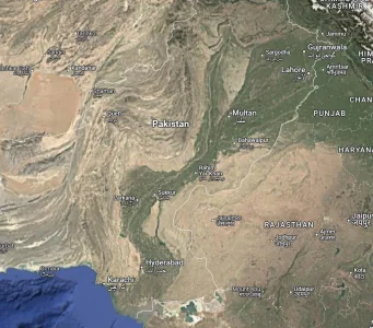
Detailed evaluation of data obtained from remote sensing, geophysical, isotopic and other studies by various workers32,33,35–40<strong> </strong>have been instrumental in sorting out many of the earlier speculative inferences and unsolved aspects of Saraswati river. Yash Pal et al.32 have traced the palaeochannel of this river through Punjab, Haryana and Rajasthan. They found that its course in these States is clearly highlighted in the LANDSAT imagery by the lush cover of vegetation thriving on the rich residual loamy soil along its earlier course. According to their findings, the river disappears abruptly in a depression in Pakistan, instead of in the sea, an observation shared by a few others also. But, digital enhancement studies35 of satellite IRS-1C data launched in 1995, combined with RADAR imagery (from European Remote Sensing satellite ERS-1/2) could identify subsurface features and thus recognize palaeochannels beneath the sands of Thar Desert. These channels are seen to extend upto Fort Abbas and Marot in Pakistan and appear in a line with present dry bed of Ghaggar (Figure 3). This river continues as Nara River in Sindh region and opens into the Rann of Kutch34. Another study33 of satellite derived data has revealed no palaeochannel link between Indus and Saraswati confirming that the two were independent rivers; also, the three palaeochannels, south of Ambala, seen to swerve westwards to join the ancient bed of Ghaggar, are inferred to be tributaries of Saraswati/ Ghaggar, and one among them, probably Drishadvati (Figure 4). The latter disappeared along with Saraswati due to shifts of its feeder streams from Siwalik and Aravalli ranges as well as due to the onset of desertification of Rajasthan15.

Geophysical surveys carried out by the Geological Survey of India to assess groundwater potential in Bikaner, Ganganagar and Jaisalmer districts in western Rajasthan desert areas have brought out several zones of fresh and less saline water in the form of arcuate shaped aquifers similar to several palaeochannels elsewhere in the State. That these subsurface palaeochannels belong to ancient rivers has been confirmed through studies37 on hydrogen, oxygen and carbon isotopes (d2H, d18O, 14C) on shallow and deep groundwater samples from these districts. The isotopic work has also indicated that there is no direct headwater connection or recharge to this groundwater from present day Himalayas. Though the antiquity of these waters and probable links to ancient rivers are thus established, the subsurface palaeochannel route beneath the desert sands obtained from hydrogeological investigations, however, differs from that derived through satellite based studies 16,35,38.

The waning period of Vedic civilization around 3700 BC was also the period that disrupted both Saraswati and Drishadvati18. Several evidences indicate that rivers of this area changed their courses often in the last 5000 y (ref. 32) and one detailed study40 about Saraswati has identified at least four progressive westward shifts in Rajasthan, due to encroaching sands. In their evaluation of the palaeochannel imagery obtained from LANDSAT, Yash Pal et al.32 observed a sudden widening of Ghaggar near Patiala which, they argue, can take place only if a major tributary had joined it. According to them, ancient Shatadru or Sutlej must have been this tributary and possibly ancient Yamuna (palaeo-Yamuna) also flowed into Ghaggar, a conclusion they claim is strengthened by archaeological findings of active life that existed at one time on their banks. During a subsequent period, Shatadru (Sutlej) swung suddenly westwards near Ropar (Figure 4) to join Indus (as also Vipas/Beas and Parasuni/Ravi, its two tributaries), deserting its earlier channel to the sea. This sudden diversion of Sutlej as well as depletion of waters from Drishadvati due to loss of its feeding streams15, appear to be major events that heralded the drying up of Saraswati. Several workers attribute this event to tectonism involving rise of Delhi-Hardwar ridge and uplift in the Aravallis11,15,16,18,32. Capture of Shatadru (Sutlej) by a tributary of Beas through headward erosion or due to diversion of Shatadru (Sutlej) through a fault are also considered as possible reasons32. Structural control over the migration of Saraswati river is also evident from studies41,42 in the Great Indian desert and adjacent parts of western Rajasthan. This area is dissected by several lineaments, some of which (e.g. Luni–Sukri lineament) were reactivated during Pleistocene–Holocene period bringing about alignment of Saraswati with Ghaggar.

Saraswati and the palaeodelta of the Great Rann

Considerable debate has taken place about Saraswati’s entry in the northern part of the Great Rann. Scholars have pointed to references in Rigveda, Manusmriti and Mahabharata about Saraswati disappearing in the sands at Vinäsana and not in the sea; but at the same time, there is also reference in some of these ancient texts about a narrow sea, possibly a creek, coming right upto Bikaner, but which disappeared during the Vedic times10,22. Rigvedic and archaeological references describe how Saraswati supported inland and marine trade and travel and that, around 3000 BC, there was continuous flow of this river upto even the Little Rann13.

The topography at the Great Rann is typically deltaic, developing usually at the mouth of rivers, confirming entry of a few rivers in the sea at this place. Neotectonism, reactivating faults and lineaments which are seen criss-crossing this region, as well as frequent seismicity, apart from Holocene sea-level changes all appear to have influenced development of a peculiar drainage topography in this area. The tilting and sinking of land resulting from the tectonic events have carved characteristic uplands (locally called Bets) representing areas of river mouth deposits, and lowlands which are sites of distributary channels17,28. Satellite imagery, as well as detailed mapping, have revealed network of distributaries and extensive graded deposits, products of Holocene marine regression17. It appears that Indus (Sindhu), Shatadru (Sutlej), Saraswati, Drishadvati (palaeo-Yamuna) and Lavanavati (possibly an ancestor of present day Luni river) had independent courses and opened into the Rann separately. According to Malik
et al.17, at least three rivers – proto-Shatadru (Hakra), Saraswati and Drishadvati must have drained into the Rann around 2000 BC, of which only Sindhu (Indus) has survived. The original delta complex with relict channels, including that of Nara, a continuation of Ghaggar, is today better preserved on the western side but covered by wind-borne deposits on the eastern part of the Great Rann17,43,44.

Yash Pal et al.32 argue that though in the satellite imagery Saraswati/Ghaggar appear to debouch into the sea or a lake near Marot or Beriwala (Pakistan) (Figure 3), this place is far interior, and unlikely to be a palaeo-seacoast, even allowing for rise of sea level during the Holocene marine transgression. In fact studies about coast line changes along the west coast have shown a much lower sea level some 12,000 y back which rose to the present level only later and had remained there for the last 7000 y. These findings, therefore, discount the possibilities of a seacoast at this place45,46 though they do not rule out the river’s entry into the sea that must have existed further south of this site in those times. It may be mentioned that Quaternary neotectonism has submerged vast areas of palaeodelta complex, possibly along with palaeochannels. In this context, it is relevant to take note of the observation that Saraswati’s ancient course in this region is in continuity with another dry river bed–Hakra or Sotra which can be traced through Bikaner to Bhahawalpur and Sind in Pakistan, and finally upto the Rann of Kutch. Such a course appears likely if we backtrack the delta distributaries inland, when it is noticed they connect up with the existing palaeochannels there. Some of these are actually extensions of relict channels seen beneath the sands of Thar Desert, as found out by geophysical and hydrogeological surveys16,17,35,38.

While tectonism had certainly a major role in shaping the fate of Saraswati and other rivers, this could not have been the only agent bringing about various changes that led to its downfall. Even though the role of climate on the disappearance of Saraswati system was underestimated by some of the earlier workers, undoubtedly it must have exercised considerable sway during the Holocene, a period during which major climatic swing has been noted globally26,27,36,47. It is well known that variation in earth’s orbit and tilt of earth’s axis affect the earth’s climate (Milankovitch and albedo forces). A drastic weather change related to these phenomena had peaked around 7000 BC26. Recent studies have shown that the onset of an arid climate occurred in two pulses –
at 4700–3700 and at 2000–1700 BC26, both of which had fairly wide impact not only in India in the desertification of western Rajasthan but in
 
other countries also, like Africa in the development of Saharan and Nubian deserts. The desertification is thought to have occurred 5400 y ago (3400 BC) and its onset greatly affected the monsoon rains and consequently the river systems too. The change from wetter to arid condition destroyed steadily the vegetation, which in turn affected soil moisture, its evaporation, atmospheric circulation and precipitation, all important links in the monsoon evolution chain and, ultimately the climate over the region. However, a recent study48 of water-table fluctuations and radiocarbon estimates from the Lunkansar Lake deposit do not support the views about aridity around 3500 BC, the period when Saraswati and Indus Valley culture were thought to have collapsed. The chronology emerging from these studies show that the once perennial lakes had ceased to be so and they had dried and desiccated more than 1500 y before the dated collapse of the civilization.

Computer based climate simulation studies26, to reproduce the changes to solar heating of the atmosphere due to variations in earth’s tilt and orbit have shown that climate-induced weakening of monsoons over India and north Africa led to desertification in a span of just 300 years. Needless to point out, when one traces the topographic evolution of a place, the influence of a combination of many natural phenomena can be recognized in its build up. It becomes, therefore, very difficult to point out any one reason for some of the major changes to the topography or river systems. The climatic swing that led to sweeping changes in northwestern India was triggered by variations in earth’s orbit and tilt and these departures are known to recur periodically. The latter should, therefore, rise the possibilities for a favourable orientation of these parameters of earth at some future time to initiate climatic conditions for a re-greening of the
Rajasthan desert, rejuvenation of the dry river beds and, hopefully, for a rebirth of Saraswati, like Phoenix out of the ashes.

artical was published in currunt science i had dig up link due to historins objection on topic
 
[td]The Indus-Sarasvati Civilization and its Bearing on the Aryan Question
shim.gif
Text of a lecture given on 29 September 1999 at Chennai’s Indian Institute of Technology (IIT-Madras), at the invitation of the students’ Vivekananda Study Circle. The talk was accompanied by a slide-show illustrating various aspects of the life of the Indus Valley civilization.​
shim.gif
[/td]
[td] [/td] [td][/td] [td]
We in India often take pride in Indian civilization, in its ancientness and great cultural traditions that go back to the dawn of ages. This is a legitimate feeling, if you consider that Americans or Australians, for instance, often take even greater pride in their countries though they are about two centuries old ; of course, their pride has to be mostly in their material achievements, since they have had little to show by way of culture, especially nowadays. India, by contrast, always laid stress on a deep culture before anything else, and yet, contrary to a common misconception, she never neglected material life either, except in recent centuries.
I would like to offer tonight some glimpses of the earliest civilization on the Indian subcontinent, and to show that its high practicality, and what we may call in our modern language its “technological” accomplishments, deserve our admiration, as does the cultural backdrop that made these accomplishments possible. I will also take a brief look at its relationship with later Indian civilization, and that will lead us to what is commonly known as the “Aryan problem.” In doing so, we will be guided by an objective scientific spirit, taking into account the most recent findings from archaeology and other fields.
Advance of Archaeology
But first, let me note a strange fact. If you open any good book on the great civilizations of the ancient world, aimed not at scholars but at a wider readership, you will almost invariably find that Mesopotamia and ancient Egypt are given pride of place ; then come, in mixed order, ancient China, Greece, Central and South America, and the Indus Valley civilization, also called the Harappan civilization. Everyone agrees that this early civilization of the Indian subcontinent was one of the largest in extent, that it made great advances in crafts and technology, in trade and agriculture, and that its social organization appears to have been one of the most efficient, methodical and trouble-free ever ; still, in the end, it will rarely be given more than a few pages where dozens will be devoted to Mesopotamia or Egypt, and today, more than seventy years after its discovery, its existence and accomplishments remain largely unknown to the general public outside the subcontinent — and inside, too.
In fact, almost everything about the Harappan civilization appears mysterious at first sight : Who were its inhabitants ? What language did they speak ? What beliefs and culture did they have ? What type of government was able to hold it together ? What caused its decline ? Why were its great cities abandoned ? Did great natural calamities take place, or should we blame wars or invoke some invasions ? And also : What connection is there between this ancient civilization and those that followed on Indian soil, in the plains of the Ganga, for example ? Is there a complete break between the two, as some Western scholars assert, or can what we call Indian civilization be traced all the way back to the Indus valley ?
Archaeologists, historians and experts from other fields have been largely unable to agree on these fundamental questions. One reason for this is the persisting lack of unanimity on the various decipherments proposed for the Indus script, found on thousands of seals and pottery pieces excavated from Harappan towns and cities. So their inhabitants remain dumb to us, their thoughts and culture unfathomable — we are left to admire their material skills, while scholars indulge in “educated guesses” on the significance of the statues unearthed, the figures engraved on the seals, the modes of burial, of government, and virtually every aspect of Harappan life. Another reason is the very small number of sites excavated, one to two per cent of all sites identified as Harappan ; this means we have barely scratched the surface, and many major findings are awaiting us a few metres underground. To give just two examples, the site of Ganweriwala, in the Cholistan region of Pakistan, is estimated to cover eighty hectares, while that of Lakhmirwala, in India’s Punjab, is thought by the Indian archaeologist J.P. Joshi to exceed 225 hectares — but neither has been excavated. A third reason has been the nineteenth-century hypothesis of an Aryan invasion into India, which insisted on placing the origins of Indian civilization somewhere in Central Asia, and therefore left the discovery in the 1920s of the Indus Valley civilization wrapped in a cloud of confusion.
As a result, till a few years ago, the Harappan world was mostly presented as anonymous and rather disembodied, with little to excite our imagination in the way Egypt’s pyramids do. As one of those general books I mentioned puts it, “The birth, life and death of the Indus civilization remain three enigmas.”[1] Not very encouraging. But the scene is fast changing : a lot of path-breaking excavations have taken place in recent years, for example at Mehrgarh and Harappa, both now in Pakistan, and in India at Dholavira and Rakhigarhri. Also, in the last three years or so, a number of excellent new studies have appeared on the Indus Valley civilization, written by Indian, American and British archaeologists.[2]Scholars from other disciplines[3] have joined them — sometimes also challenged them — some old misconceptions are giving way, and a clearer picture is slowly emerging. In a few years from now, we can expect this civilization to take its rightful place as one of the greatest of the ancient world, with most of its “enigmas” dispelled. Today, let us just try to take stock.

1750266781187.webp
Physical Data
The most physical data about the Harappan civilization are clear enough : As of last year, it was said to comprise more than 1,500 settlements, most of them small villages or towns, with only a few large cities. Some of the “villages” covered more than twenty hectares ; the cities, in comparison, often extended over some eighty hectares — Mohenjo-daro up to 250 hectares, about the size of the entire I.I.T. campus where we are gathered tonight. However, new sites are added every week or month, and the U.S. archaeologist Gregory L. Possehl, in a just published monumental study,[4] gives a detailed list of 2,600 Harappan sites ! What the final figure will be is anyone’s guess.

The total area encompassed was huge : over one million square kilometres — more than ancient Egypt and Mesopotamia put together, or, if you prefer, eight times the size of Tamil Nadu. The southern limit was between the Tapti and the Godavari rivers, while the northern limit was some 1,400 kilometres away in Kashmir (at Manda) — though one site, Shortughai, is found still farther up, in Afghanistan ; as of now, the easternmost settlement stands at Alamgirpur in Western Uttar Pradesh, and the western limits were the Arabian sea and the whole Makran coast, almost all the way to the present Pakistan-Iran border.

If this civilization was named after the Indus, it is because the first major settlements, Mohenjo-daro and Harappa, were found along that river and its tributary, the Ravi. However, in recent decades, exploration on both sides of the Indo-Pakistan border has brought to light hundreds of sites along the dry bed of a huge river in the Ghaggar-Hakra valley.[5] This lost river is now widely recognized to have been the legendary Sarasvati praised in the Rig-Veda (which also mentioned the Indus, or “Sindhu,” and all other major rivers of Punjab). The course of the Sarasvati, south of and broadly parallel to that of the Indus, has been studied and plotted in some detail not only by geological exploration, but also by satellite photography and recently by radioisotope dating of the water still found under the river’s dry bed in the Rajasthan desert.[6] Since the sites found along the Sarasvati far outnumber those in the Indus basin, some scholars have made the point that the Harappan civilization would be better named the “Indus-Sarasvati civilization.” For instance, the giant sites of Ganweriwala and Lakhmirwala which I mentioned earlier are located on the course of the Sarasvati, as are the better known settlements of Kalibangan and Banawali. Of course, the name “Indus-Sarasvati civilization” still leaves out a number of sites in Gujarat, such as Lothal, but it stresses the importance of the Sarasvati river as the major lifeline of this civilization, the Indus coming a close second.

Whatever its name, when we speak of this civilization, we usually mean its “mature phase” (also called “integration era”), during which the great cities such as Mohenjo-daro, Harappa, Ganweriwala, Rakhigahri, Dholavira and others flourished. That phase is now usually dated 2600-1900 BC. But it was of course not born in a day : it was preceded by a long phase called “early Harappan” or “regionalization era,” during which villages kept developing and started interacting, and also many technologies (pottery, metallurgy, farming etc.) were perfected ; that early phase is now dated by Jonathan Mark Kenoyer, a U.S. archaeologist who has worked on many Indus sites, 5000-2600 BC. It was itself the result of a long evolution between 7000 and 5000 BC, which saw the emergence of the first village farming communities and pastoral camps (as in many other regions of the world) : Mehrgarh, at the foot of the Bolan Pass in the Kachi plain of Baluchistan, is the best known example ; according to its excavator, the French archaeologist Jean-François Jarrige, “The site covers an area of about 500 acres [200 hectares] with only pre-Harappan remains” and shows “evidence of continuous occupation for more than three millennia prior to the Harappan civilization.”[7]

The end of the mature phase is usually dated 1900 BC, when most of the cities were gradually abandoned ; their remarkable civic organization broke down, forcing people to go back to the villages. The most probable cause was a series of natural catastrophes — earthquakes, drastic changes in river courses, consequent depletion of the Sarasvati, floods, but also a long drought over the whole region (including West Asia), all of which ravaged agriculture, and perhaps also excessive deforestation to supply wood to kilns and furnaces. Another likely factor is a sharp reduction in external trade, especially with Mesopotamia. But, while earlier generations of scholars spoke of a total break in Indian civilization as a result of this decline, archaeologists now agree that another phase, called post-Harappan, post-urban or also “localization era,” and dated about 1900-1300 BC, followed, and went on to provide a smooth transition to the first historical states in the Ganga region.

The Cities

What impressed the first discoverers of Harappan cities most was their sophistication, which displayed town-planning of a level that would be found only 2000 years later in Europe. Geometrically designed, the towns had fortifications (for protection against both intruders and floods), several distinct quarters, assembly halls, and manufacturing units of various types ; some bigger cities had furnaces for the production of copper tools, weapons or ornaments ; public baths (probably often part of temples), private baths for most inhabitants, sewerage through underground drains built with precisely laid bricks, and an efficient water management with numerous reservoirs and wells show that the ordinary inhabitant was well taken care of. Mohenjo-daro, for instance, is thought to have had over 700 wells, some of them fifteen metres deep, built with special trapezoid bricks (to prevent collapse by the pressure of the surrounding soil), and maintained for several centuries. Quite a few of those wells were found in private houses. Dholavira had separate drains to collect rain water and six or seven dams built across nearby rivers. “The fact that even smaller towns and villages had impressive drainage systems,” remarks Kenoyer, “indicates that removing polluted water and sewage was an important part of the daily concerns of the Indus people.”[8] I am sure that many of our villages in today’s rural India would be quite happy with such an infrastructure — maybe the candidates at present roaming our dusty roads in search of votes should study Harappan public amenities !
Drains from individual houses
empty into a covered collective drain in Mohenjo-daro.


The well-known Indian archaeologist, B. B. Lal, writes in a recent comprehensive study of this civilization :

Well-regulated streets [were] oriented almost invariably along with the cardinal directions, thus forming a grid-iron pattern. [At Kalibangan] even the widths of these streets were in a set ratio, i.e. if the narrowest lane was one unit in width, the other streets were twice, thrice and so on. [...] Such a town-planning was unknown in contemporary West Asia.[9]
md_map.gif

The houses were almost always built with mud bricks (sometimes fired in kilns), which followed a standard ratio of 4 :2 :1, though the actual sizes varied : bricks for houses, for instance, might be 28 x 14 x 7 cm, while for fortification walls they could be 36 x 18 x 9 cm or even bigger. Walls were on average seventy centimetres thick (which I suppose would be nearly three times the thickness of your hostel walls), and many houses were at least two storeys high. A few houses, perhaps those of rulers or wealthy traders, were particularly large, with up to seven rooms, but they might be found right next to a craftsman’s modest house. A number of big buildings, such as that around Mohenjo-daro’s “Great Bath,” seem to have served a community purpose, sometimes perhaps that of temples. Dholavira, in Kutch, even boasts a huge maidan. It also has massive fortification walls, some of them as thick as eleven metres, built in the earliest stage of the city ; apart from standardized bricks, stones were also used there on a large scale, undressed as well as dressed (note that stones were perfectly dressed with just copper tools : iron was not yet known).

Map of one area of Mohenjo-daro (“HR area”),
as an example of complex town-planning 4,500 years ago.


chessmen.jpg
[/td]
 

Users who are viewing this thread

  • Latest Replies

    Featured Content

    Trending Threads

    Back
    Top