- Joined
- Jul 2, 2024
- Messages
- 890
- Likes
- 2,306
Was he trying somehow to land on the road..could have minimised loss of life. Or perhaps the clearing open land to the left perhaps. Om shanti.
IMO i don't think so. Neither the road was in-line, nor it & open areas visible due to trees. A drone view from apogee point flying towards the crash area can reveal things better.
The plane fell in a less dense spot over roof of the mess then in compound of the hostel, all areas around have highly dense residence.
From crash vids & pics it appears - If pilot could see the ground, may be he pulled up nose to avoid head-on collision with mess, causing the tail to hit mess & break, remaining fuselage exploded, skid on rooftop, may be bounced little, rolled right & left wing hit the building, fuselage brushed the buildings & hit compound ground.
If the failure happened sooner or slightly later then there would be no clean area with much higher ground casualties.
If failure happened say after a minute then pilots would be in similar situation as captain Sully, with Sabarmati river nearby.
Pilots do train for crashes due to numerous reasons, in different terrain.
An extremely proactive pilot might even study Google Maps around airport before next flight, IDK. That's exceptional navigation skill. But failure can happen at any unfavorable moment.
If T/o to crash is 32 seconds then engines must have failed around 8-10 seconds, 1/4th to 1/3rd of distance, 22-24 seconds remaining.
1 or both pilot(s) would try to look quickly at MFDs - error messages, RPM, electrical, hydraullics, etc, perhaps try to restart engines.
1 pilot may to scout the area; from security CCTV footage the jet does roll right little then left then centers, but a jet cannot maneuver much at such low altitude & short time of 8-16 seconds with emergency power from batteries + RAT also.
Excess pulling could have caused stall.
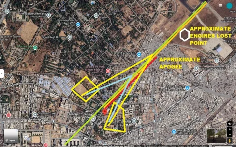
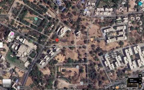
APOGEE or highest altitude was 625 ft. from MSL (Mean Sea Level) & 400 ft. AGL (Above Ground Level), 16 seconds remaining.
400 ft = 40 floors building roughly.
If we check Google Earth,positioning at approximate apogee point, at 400 ft., & look towards crash site, then the pilots would have seen something like this (16 seconds remaining) :
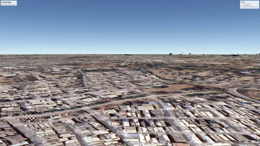
It was take-off phase, then loss of thust, so AoA (Angle of Attack) was high, hence downwards visibility of ground is very limited, but 787 windshield has good size & FoV (Field of View).
We can watch many landing videos on Youtube.
Now if we imagine trees, they will obscure the open land also, it is trigonometry.
If the pilot scouts an open land at apogee & steer with emergency power, then there are better chances.
The following are pics of -
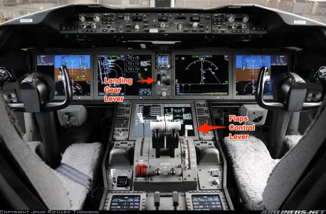
- regular eye view in cockpit
- zoomed view out of clean flat terrain
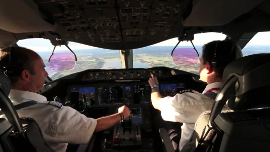
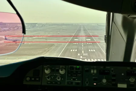
Look at the height of tail of plane on ground through the left HUD. Trees can be even more tall than that.
I put the RED lines & we can see how much huge land trees can obsure.
The slender wings of airliners are designed for subsonic cruise, not perfect glider.
If we combine the above pic & Googe Earth view, we get this:

So unless someone shares a drone view from apogee point at 400 ft., i think from cockpit PoV, the city dwelling around airport didn't give much chance to pilots.
The airport is in NE quadrant of city.
If planes take off towards NE direction then also dwellings are there.


