You are using an out of date browser. It may not display this or other websites correctly.
You should upgrade or use an alternative browser.
You should upgrade or use an alternative browser.
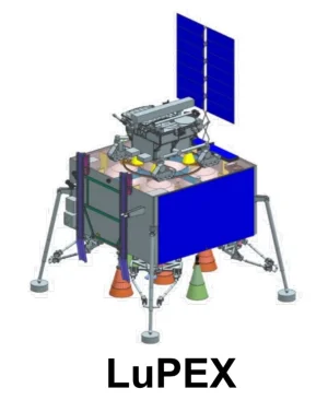
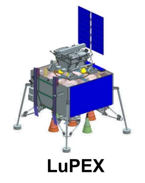
JAXA-ISRO Lunar Polar Exploration (LUPEX) Mission
- Thread starter haldilal
- Start date
More options
Who Replied?- Joined
- Jun 30, 2024
- Messages
- 1,284
- Likes
- 15,170
- Joined
- Jul 5, 2024
- Messages
- 620
- Likes
- 2,769
- Joined
- Jul 5, 2024
- Messages
- 620
- Likes
- 2,769
- Joined
- Jun 30, 2024
- Messages
- 1,889
- Likes
- 6,556
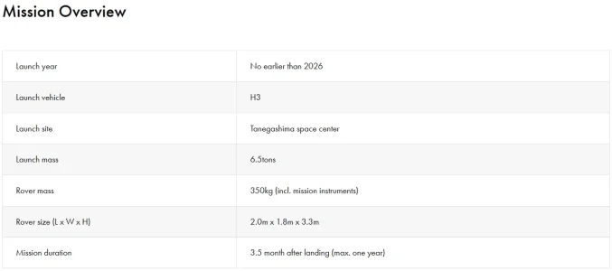
What is the launch date again?
- Joined
- Jun 30, 2024
- Messages
- 2,763
- Likes
- 24,296
- Joined
- Jun 30, 2024
- Messages
- 2,763
- Likes
- 24,296
- Joined
- Jun 27, 2024
- Messages
- 2,792
- Likes
- 9,315
- Joined
- Jun 27, 2024
- Messages
- 2,792
- Likes
- 9,315
- Joined
- Jun 27, 2024
- Messages
- 2,792
- Likes
- 9,315
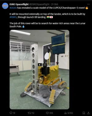
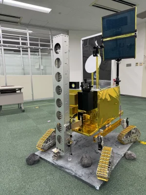
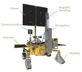
LUPEX Rover’s Mission Instruments
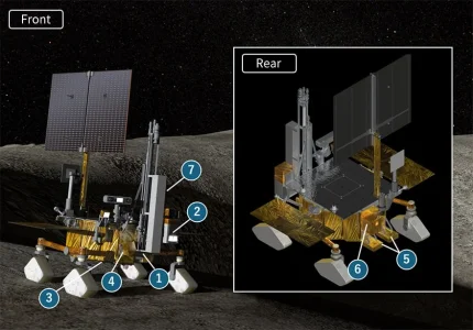
① Resource Investigating Water Analyzer (REIWA)
• Lunar Thermogravimetric Analyzer (LTGA)
• Triple-reflection Reflectron (TRITON)
• Aquatic Detector using Optical Resonance (ADORE)
• ISRO Sample Analysis Package (ISAP)
② Advanced Lunar Imaging Spectrometer (ALIS)
③ Neutron Spectrometer (NS)
④ Exospheric Mass Spectrometer for LUPEX (EMS-L)
⑤ Ground Penetrating Radar (GPR)
⑥ Mid-Infrared Imaging Spectrometer (MIR)
⑦ Permittivity and Thermophysical Investigation for Moon's Aquatic Scout (PRATHIMA)
- Joined
- Jul 4, 2024
- Messages
- 597
- Likes
- 1,277
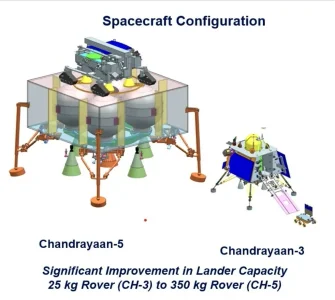
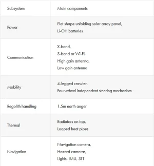
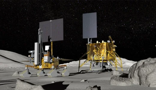
does Isro going to contribute only lander ?LUPEX Rover System
View attachment 23992
View attachment 23993
Is jasax not able to make lander, why they ask ISRO for it ?
- Joined
- Jun 27, 2024
- Messages
- 2,792
- Likes
- 9,315
International Collaboration
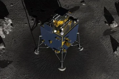
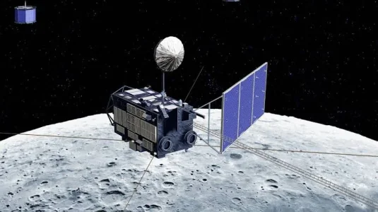
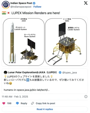
LUPEX is an international joint mission with the Indian Space Research Organization (ISRO). Japan will be responsible for the development and operation of the launch vehicle and rover, while India will be responsible for the development and operation of the lander.
The LUPEX rover will carry not only Japanese instruments but also Indian, American, and European instruments.
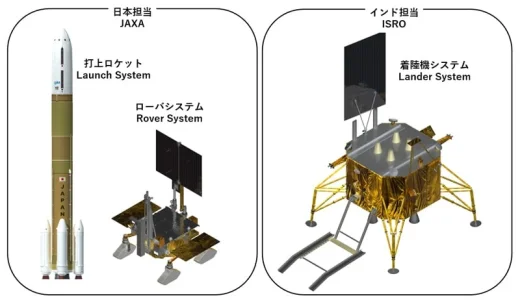
Division of Responsibility between JAXA and ISRO
does Isro going to contribute only lander ?
Is jasax not able to make lander, why they ask ISRO for it ?
Last edited:
- Joined
- Jun 27, 2024
- Messages
- 2,792
- Likes
- 9,315
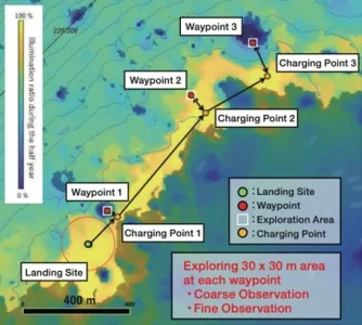
Exploration Area and observation flow
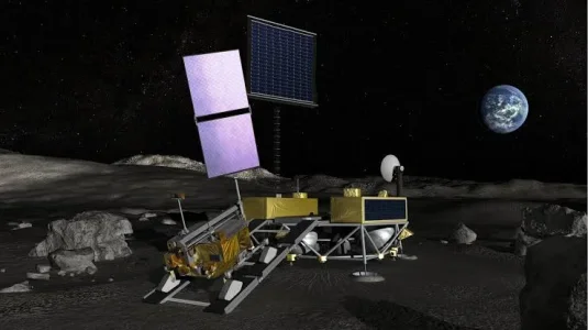
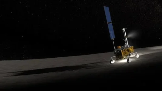
Near the landing site, target points (waypoints) and exploration areas with characteristic features of temperature, illumination, and geology will be selected, and a global path will be planned in advance. From the landing site, the rover will move to the exploration area based on the path plan, conduct observation operations, and recharge batteries.
The following observation operations will be carried out :
Last edited:
Latest Replies
-
Operation Sindoor
- haldilal
-
Chit Chat
- apoorv465
-
Naxal Maoist Insurgency
- Wayfarer
-
Sinking State of Bangladesh: Idiotic Musings
- Gandaberunda
-
Jokes Thread
- SKC
-
Electronics and Semiconductor Manufacturing Industry
- FalconSlayers
-
Indian Economy
- Wayfarer

